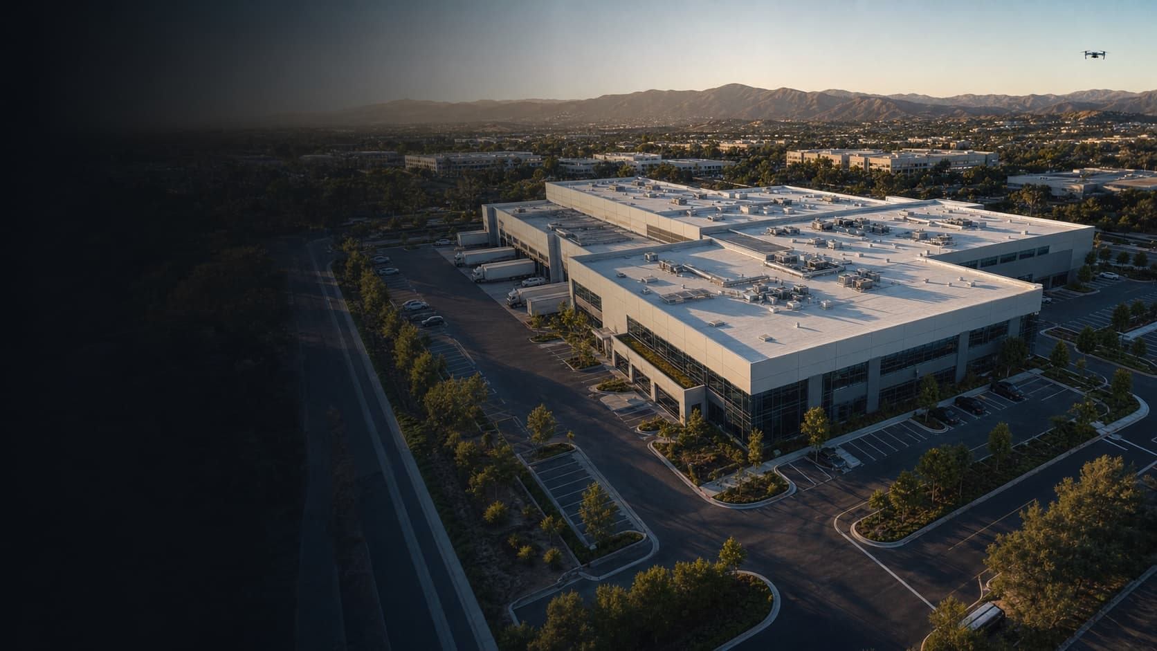
01
Commercial property records
Rooflines, facades, parking, loading, access, perimeter, and site context organized around the asset.
A complete current property record
For companies, operators & authorized teams
Solvd Air gives property and project teams a consistent visual record they can compare, share, and use to make the next decision without chasing loose files.
Licensed FAA Part 107 pilots
Permits handled across Southern California
Results usually within 24 hours
Private project delivery
Services built around the decision
01
Rooflines, facades, parking, loading, access, perimeter, and site context organized around the asset.
A complete current property record
02
Installation progress, array overview, surface condition imagery, and optional thermal capture when separately scoped.
A reviewable solar asset history
03
Repeatable angles, dated milestones, stakeholder updates, and visual history across reporting cycles.
Progress that is easier to verify
04
RGB field overview, access routes, irrigation context, acreage records, and repeatable change monitoring.
Consistent land and field context
05
Condition-focused image sets for roofing, facilities, solar, ownership, and vendor planning.
Clear visual scope before site work
06
Situational imagery and search-area documentation for authorized agencies and response teams when flight conditions and approvals allow.
Timely aerial context for coordinated teams
Who this serves
Property and facility management
Roofing and solar operations
General contractors and developers
Agricultural and land operators
Real estate and leasing teams
Authorized public-safety partners
Multispectral, thermal, LiDAR, survey-grade, emergency-response, engineering, and diagnostic outputs are only offered when the required equipment, qualified interpretation, operating conditions, and authorizations are confirmed.
Start with the location