01
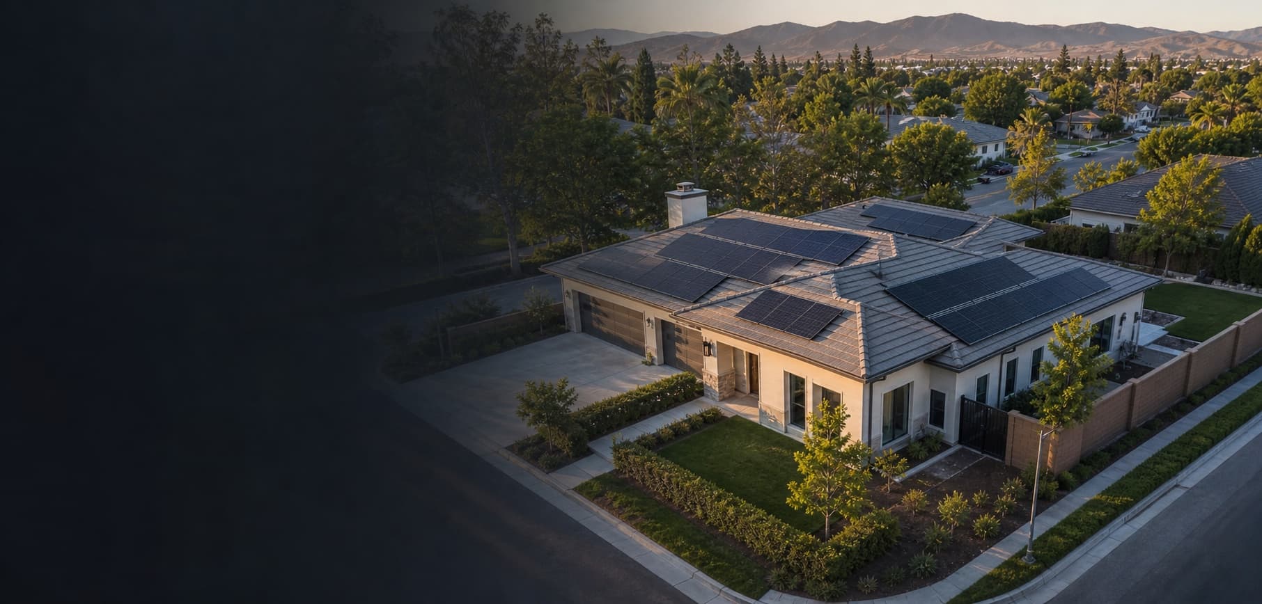
Home roof & exterior record
Top-down and angled views of roof surfaces, exterior areas, access points, and visible property context.
See areas that are difficult to view from the ground
For homeowners, landowners & private clients
Professional aerial records for roofs, homes, land, solar installations, property sales, and hard-to-see exterior areas.
Licensed, insured pilots
Permits handled for you
Results usually within 24 hours
Private delivery link
Services built around the decision
01
Top-down and angled views of roof surfaces, exterior areas, access points, and visible property context.
See areas that are difficult to view from the ground
02
A clear visual baseline after installation or before discussing maintenance with a qualified provider.
A dated record of the installed system
03
Boundary context, access roads, vegetation, structures, and broad land conditions captured from above.
Understand a large property in one view
04
Visual records before and after repairs, exterior work, landscaping, construction, or weather events.
A practical history for comparison
05
Aerial photos and short video that show the property, lot, neighborhood context, and outdoor features.
Present the property with more context
06
Focused imagery of exterior areas that can be seen safely from permitted flight positions.
Get visual context before calling a specialist
Who this serves
Homeowners
Residential property buyers and sellers
Private landowners
Owners planning roof or solar work
Families documenting a property
Clients coordinating with contractors
Solvd Air provides visual records unless a specialized service is explicitly scoped. Images do not replace licensed roofing, engineering, surveying, insurance, agricultural, legal, or emergency services.
Start with the location